
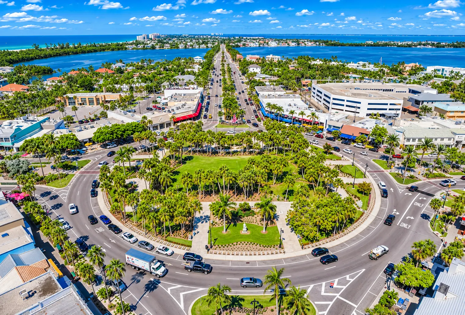
Here is what daily life near the Circle is really like, from parking and events to flooding, before you buy or sell.
- JurisdictionCity of Sarasota, Sarasota County
- Historic districtHarding Circle, National Register of Historic Places (2001)
- AccessJohn Ringling Causeway (SR 789) from downtown
- Home typesSingle-family streets, plus condos and mixed-use near the Circle
Overview: Life Around the Circle
St. Armands Circle is one of the few places in Sarasota where you can leave the car at home for the whole day: coffee, lunch, a gift, an evening stroll, and the Gulf within a short walk.
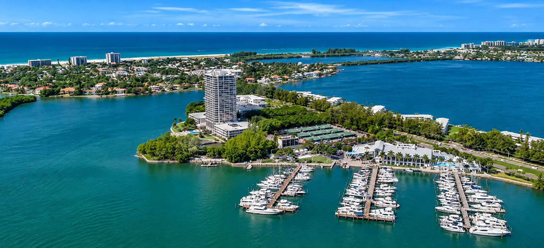
The Circle is the commercial heart of St. Armands Key, a small island neighborhood in the City of Sarasota between Bird Key and Lido Key. Shops and restaurants ring a palm-filled park, and residential streets fan out on every side. Living here means a village routine on foot, with downtown Sarasota across the bay. It also means sharing your neighborhood with visitors, event weekends and the flood risk that comes with a low-lying island. This guide covers the Circle and the streets around it. For Lido’s beaches, condo towers and the island’s storm history, see our Lido Key & St. Armands guide.
How the Circle Is Laid Out
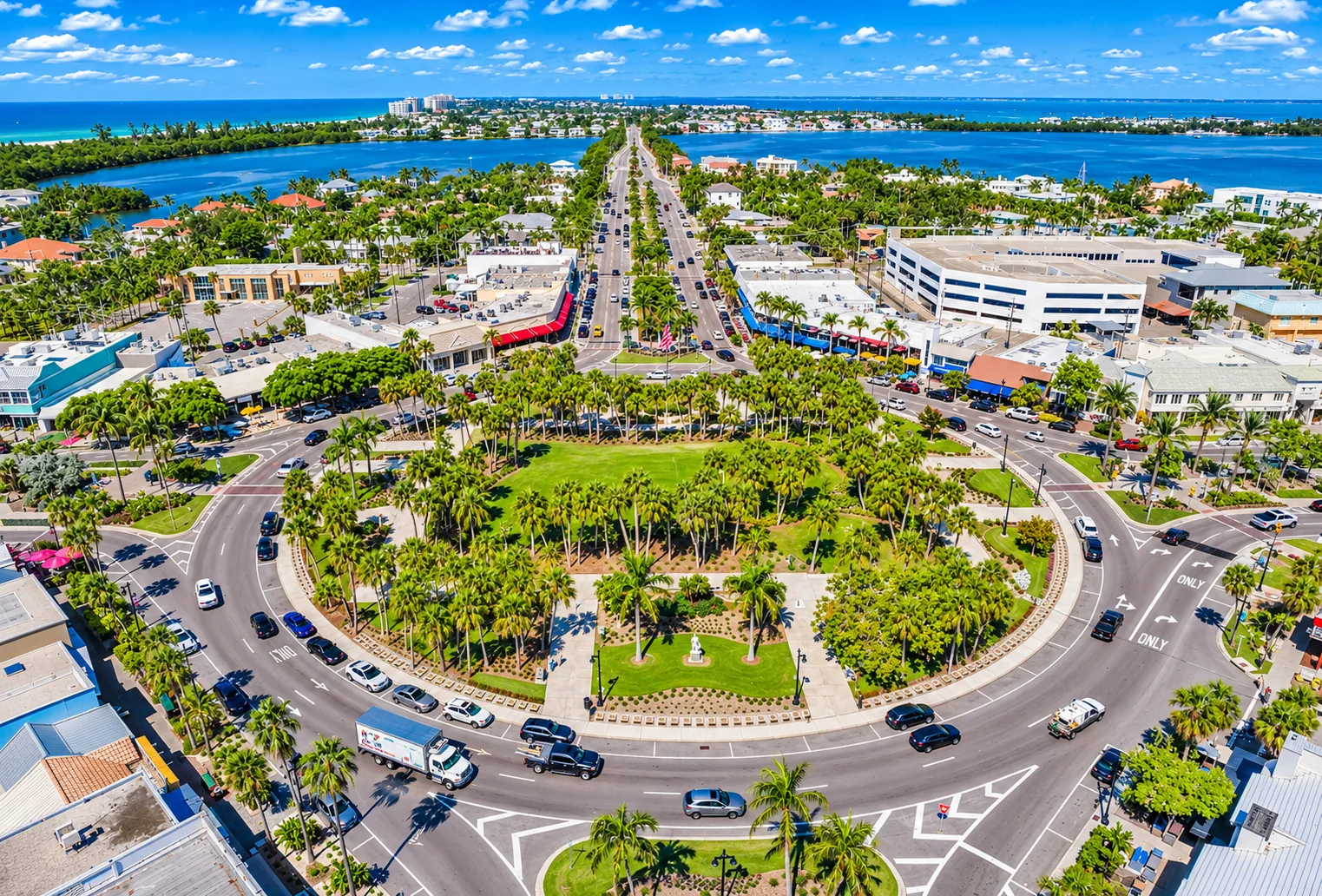
The Circle’s plan has barely changed in a century. Circus magnate John Ringling bought St. Armands Key and, with his partner Owen Burns, laid out a development of shops around a central park, with homes along the boulevards and canals beyond. Local histories date his purchase to 1917, while the state historical marker says 1923. According to that marker, landscape architect John J. Watson designed the central park, boulevards and medians, and the park was named for Ringling’s friend, President Warren Harding.
Two boulevards cross at the Circle. John Ringling Boulevard runs east toward Bird Key and downtown and west toward Lido Key. The Boulevard of the Presidents runs north and south. Together they divide St. Armands Key into four residential quarters, and the shops sit on the ring road and the first blocks of each boulevard.
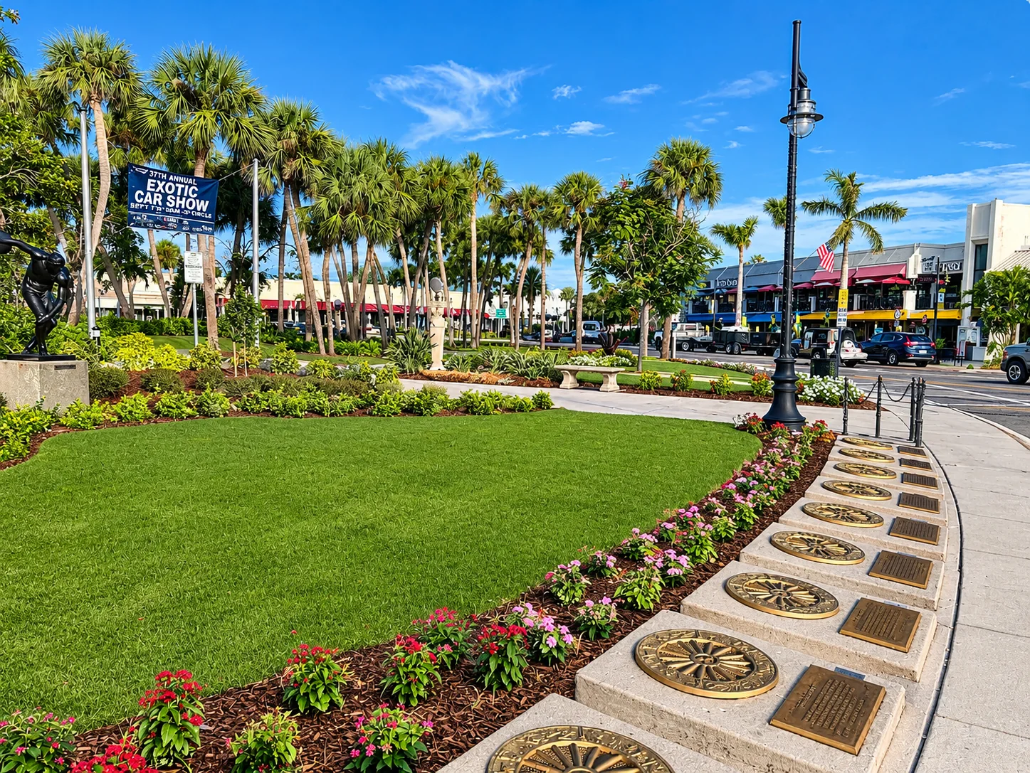
The park, its medians and the Ringling-era statuary form the Harding Circle Historic District, listed on the National Register of Historic Places on January 16, 2001. According to the St. Armands Residents Association, 16 Ringling-era statues of stone or bronze stand on the district’s medians, and 21 hand-carved marble statues in classical style were added in 2007. Historian Jeff LaHurd, writing in Sarasota Magazine, notes that John Ringling’s St. Armands office building still stands on the Circle and has housed restaurants for decades. For the rest of the Ringling story, including the 1926 causeway opening and the Circus Ring of Fame, see our Lido Key & St. Armands guide.
Shops, Dining and the Daily Walk
The St. Armands Circle Association, which represents the Circle’s merchants, counts almost 130 members. Its directory groups them into fashion and footwear, jewelry and accessories, specialty and gift shops, restaurants, ice cream and confections, and salons, spas and medical offices. The City of Sarasota has described most of the Circle’s businesses as independently owned. One long-standing anchor is the Columbia Restaurant at 411 St. Armands Circle, which reopened in October 2024 after the hurricanes and calls itself the oldest operating restaurant in Sarasota.
On the Circle, the walk is the point. Residents use it like a small-town main street: an early coffee, errands on foot, lunch on a patio, and a loop around the park after dinner. The mix of businesses changes from season to season, and in 2026 city-led visioning sessions listed vacancies, tenant mix and the condition of older commercial buildings among residents’ and merchants’ concerns, along with traffic and flooding. For the current lineup, check the St. Armands Circle Association directory.
On the Circle, the walk is the point.
A Year on the Circle
The Circle has a busy event calendar, and if you live nearby you will feel it, mostly in good ways. The Association’s 2026 calendar included:
- Art and craft festivals in January, June, September and November, most with a sidewalk sale by the Circle’s shops.
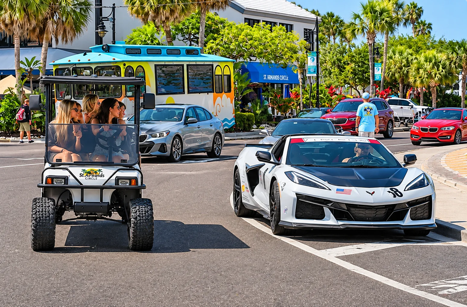
- Car shows on several mornings through the year, featuring classic cars, Corvettes, Ferraris, Jaguars and Porsches.
- Fright Night on Halloween, with trick-or-treating hosted by the merchants.
- Holiday Night of Lights in early December, a long-running tradition with free children’s activities and the lighting of the Circle’s holiday tree.
Other organizers also hold art shows in Circle Park, and dates change each year, so check the Association’s events page. On event days, expect more traffic, fuller parking and, at the garage, possible flat-rate pay-on-entry parking set by the city. Season matters too: winter and spring weekends are the Circle’s busiest times.

The Residential Streets Around the Circle
Step a block or two off the Circle and St. Armands becomes a quiet neighborhood of palms, medians and low-rise homes. Many street names honor U.S. presidents, including Washington, Adams, Madison, Monroe, Polk and Fillmore drives and the Boulevard of the Presidents itself.
Original 1920s homes
Ringling and Burns platted and sold homesites in the 1920s, and a few homes from that era, in the Mediterranean Revival and Spanish styles, still stand. They are rare and often have history worth researching before you buy.
Mid-century and newer homes
According to the residents association, St. Armands came back to life after business returned to the Circle in 1953. Today, older ground-level houses now sit beside newer, elevated homes built to current flood rules, so two homes on the same block can carry very different flood risk and insurance costs.
Canal and bay frontage
Some lots on the outer streets back onto canals or the bay, with seawalls and docks. Ask about seawall condition, dock permits and the route and depth to open water.
Condos and mixed-use near the Circle
Closest to the shops, condos and buildings with residences over storefronts offer lock-and-leave living a few steps from dinner. Each building has its own rules, fees and reserves, and some may face more event-night noise.
The St. Armands Residents Association represents residents of St. Armands and the nearby barrier island neighborhoods to the city. If you plan to park on the street near your home, the City of Sarasota offers a St. Armands residential parking permit for people who live within 1,000 feet of the permitted spaces. It uses a waitlist and requires proof of residency, and since January 1, 2026, permits have been month-to-month.
Getting Around on Foot, by Bike and by Trolley
Living near the Circle, many trips are short enough to walk or bike. These routes start at the center of the Circle:
| To | Distance | Walk | Bike |
|---|---|---|---|
| St. Armands Garage (57 N. Adams Dr.) | About 0.1 miles | About 2 minutes | About 1 minute |
| Lido Beach Pavilion | About 0.7 miles | About 15 minutes | About 5 minutes |
| Bird Key entrance (Bird Key Drive) | About 1.1 miles | About 24 minutes | About 8 minutes |
| Mote Marine Laboratory & Aquarium (City Island) | About 1.4 miles | About 30 minutes | About 10 minutes |
| Bayfront Park, downtown Sarasota (over the Ringling Bridge) | About 2.7 miles | About 1 hour | About 20 minutes |
Estimates from OpenStreetMap walking and cycling routes on November 4, 2026, at an easy pace. Times do not include crossings, heat or construction detours.
The trolley. Breeze Transit’s free, open-air Bay Runner trolley runs from downtown Sarasota over the Ringling Bridge, past Bird Key, around St. Armands Circle and out to the Lido Beach pavilion and Ted Sperling Park. Visit Sarasota lists service from 7 a.m. to 10 p.m. Sunday through Thursday and until 11 p.m. on Friday and Saturday. Check the Bay Runner app for live times.
Parking. The city owns and manages the Circle’s parking, more than 1,600 spaces in all, according to the Circle Association. The St. Armands Garage holds about 480 cars and has EV chargers, and the Fillmore lot and metered street spaces fill in around it. Rates and enforcement hours changed in 2026. As of September, the city had suspended its new extended enforcement hours, and the City Commission is expected to revisit parking after the November 3 election. Check the city’s garage page for current rules.
The causeway. FDOT is rebuilding SR 789 between Bird Key Drive and Sunset Drive, adding dedicated bicycle and transit lanes on the Ringling Bridge, new signals and drainage. The state expects to finish in early 2027. See FDOT’s project page for lane closures.
St. Armands, Lido Key and Bird Key
The three keys work as a set, and where you live among them shapes your day.
St. Armands: the village
Homes within walking distance of the shops and restaurants, on streets laid out around the Circle. The appeal is convenience and character, and the trade-off is visitors and traffic close to home.
Lido Key: the beach
West of the Circle along John Ringling Boulevard, Lido is mostly condominiums near the Gulf, plus single-family Lido Shores at the north end. Many Lido residents walk or bike to the Circle. See our Lido Key & St. Armands guide.
Bird Key: the quiet island
East of St. Armands on the causeway, Bird Key is a deed-restricted, single-family island reached by one road, Bird Key Drive. The Circle is about a mile away. See our Bird Key guide.
North of the Circle, the road continues across the New Pass Bridge to City Island and Longboat Key. See our Longboat Key guide.
Flooding on the Circle
Flooding is the biggest practical issue for anyone buying near the Circle. St. Armands Key is low-lying, and rain at high tide can back up the drainage system. Hurricane Helene’s storm surge flooded the Circle and its streets in September 2024, and local reporting says every store on the Circle took on water. In July 2026, about 2.2 inches of rain in two hours, during high tide, flooded the Circle again; Sarasota County said one of the Circle’s five drainage pumps had failed to start because of a faulty sensor, since repaired.
Sarasota County manages stormwater on St. Armands under an agreement with the city. In December 2025, the County Commission set aside $13.5 million in federal Resilient SRQ recovery funds, along with about $479,000 from the city, for St. Armands drainage. Plans under discussion include pump station and generator upgrades and tide check valves that keep seawater out of the pipes. In April 2026, the county said construction could begin around 2029, depending on design and permitting.
Before you buy near the Circle
- Check the flood zone on FEMA’s Flood Map Service Center and ask for an elevation certificate.
- Ask what flooded in 2024 and since, what was repaired and permitted, and whether the city issued a substantial damage determination under the FEMA 50% rule. Our Lido Key & St. Armands guide explains that rule.
- Get wind and flood insurance quotes during your inspection period, and compare elevated and ground-level homes.
- For a condo, request the latest milestone inspection, reserve study, budget and any special assessments.
Is Living near the Circle Right for You?
- You may love it if you want to walk to dinner, like a lively, historic setting, and want the beach and downtown both close by.
- Think it through if you prefer total quiet, dislike event-weekend crowds or need easy guest parking, or if a ground-level home’s flood exposure would worry you.
St. Armands Real Estate Market Snapshot
- Walking distance drives value. Buyers often weigh how many blocks a home is from the Circle and from Lido Beach.
- Elevation and storm history matter as much as finishes, because of the 50% rule and insurance costs.
- Waterfront and original homes are a small share of the market and often trade on their own terms.
Thinking about selling near St. Armands Circle?
Value depends on your distance to the Circle, water frontage, elevation, storm repairs and updates.
St. Armands Circle FAQ
Where is St. Armands Circle?
St. Armands Circle is the shopping and dining district at the center of St. Armands Key, a barrier island neighborhood in the City of Sarasota. It sits between Bird Key and Lido Key on the John Ringling Causeway (State Road 789), across Sarasota Bay from downtown.
Can you live within walking distance of St. Armands Circle?
Yes. Residential streets surround the Circle on all four sides of St. Armands Key, so many homes are a few blocks from its shops and restaurants. Lido Beach is about 0.7 miles from the Circle on foot, roughly a 15-minute walk.
What kinds of homes are near St. Armands Circle?
Mostly single-family homes on the residential streets around the Circle, from a few surviving 1920s Mediterranean Revival houses to newer elevated homes, some on canals. Condos and mixed-use buildings sit closer to the Circle, and Lido Key’s condo towers are a short walk west.
Where do you park at St. Armands Circle?
The City of Sarasota runs the paid street parking, the Fillmore lot and the St. Armands Garage at 57 North Adams Drive, which holds about 480 cars. Rates and enforcement hours changed in 2026 and are under review, so check the city’s parking pages before you go. Residents can apply for a city residential parking permit.
How do you get from St. Armands Circle to Lido Beach and Bird Key?
John Ringling Boulevard runs west from the Circle to Lido Key and Lido Beach. Heading east on the causeway, Bird Key Drive is about a mile away. The free Bay Runner trolley also links downtown Sarasota, Bird Key, St. Armands Circle and Lido Beach.
What events happen on St. Armands Circle?
The St. Armands Circle Association’s 2026 calendar included several art and craft festivals with sidewalk sales, car shows, a Halloween Fright Night and the Holiday Night of Lights in early December. Most events are free to attend.
Does St. Armands Circle flood?
It can. Heavy rain at high tide and storm surge have flooded the Circle and nearby streets, including during Hurricane Helene in 2024 and a downpour in July 2026. Sarasota County, which manages stormwater there, has set aside $13.5 million in federal recovery funds for drainage improvements, with construction expected to start around 2029.
What schools serve homes near St. Armands Circle?
When we checked addresses on St. Armands Key against the Sarasota County Schools zone map for our Lido Key and St. Armands guide, they were zoned for Southside Elementary, Booker Middle and Booker High. Zones can change, so confirm any address with the district.
Ready to Make Your St. Armands Move?
Clear, local, no-pressure advice for buyers near the Circle.
- John Brink, “Broker Brink”
- The SRQ Premier Team | Bright Realty
- Phone: (941) 928-5555
- Email: info@brokerbrink.com
- www.brokerbrink.com
Information in this guide is believed accurate as of November 2026 and is provided for general information only. It is not legal, insurance or financial advice. Parking rates and rules, event dates, business listings, school zones, flood maps, floodplain rules, laws, transit schedules and construction timelines change. Verify all details independently before you buy or sell. Distances and walking and biking times are approximate. Historical, merchant, event and resident details are as reported by the cited organizations, agencies and publications. Listing information is provided through the MLS and is deemed reliable but not guaranteed.